GPS auto-locate
The map moves to your exact position automatically, so crews always know where they stand relative to every nearby asset.

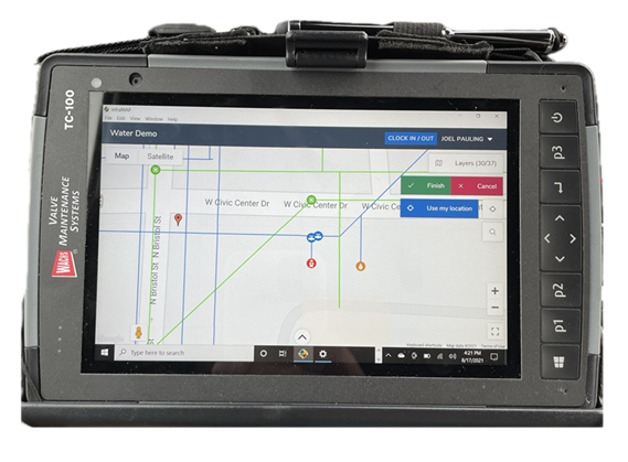
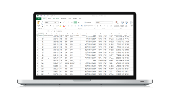
Cloud-based GIS utility management software that puts your entire system in the palm of a field crew's hand.
GPS-guided mobile mapping, asset inspections, and maintenance recordkeeping - built for water, wastewater, stormwater, gas, and electric utilities. No GIS experience required.
Authorized infraMAP® partner for the Rocky Mountain region - Colorado · Utah · Wyoming · Montana · Idaho
What is infraMAP®
infraMAP® is a GPS-guided mobile GIS platform that brings field crews, management, GIS, and engineering together in a single commercial off-the-shelf system. Crews locate, inspect, and update utility assets right from the map - in real time or fully disconnected in remote areas.
Created by iWater in 2002 to cut overtime and eliminate paperwork, infraMAP® has been refined for more than two decades by the people who use it every day. The result is software that's genuinely easy to learn, yet powerful enough to run an entire utility's maintenance program from a rugged tablet.
Capabilities
One interface for the whole asset lifecycle - locate, inspect, record, report, and repeat.
The map moves to your exact position automatically, so crews always know where they stand relative to every nearby asset.
Pull up as-built drawings with a single click directly from the map - no more digging through plan rooms or PDFs.
Draw, mark, and correct the GIS right where the discrepancy is. Redlines flow straight back to the office for review.
Run a shut-off trace to see exactly which valves to operate to isolate a main - critical during a break or emergency.
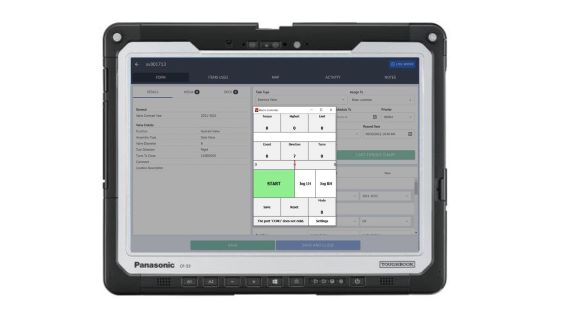
Configurable inspection forms capture condition data in the field - no end-of-day data entry back at the yard.
Turn live field data into compliance-ready reports instantly - work performed, history, and lifecycle status on demand.
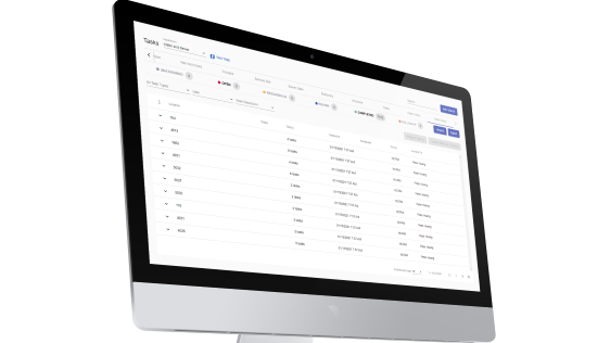
Create immediate tasks or schedule recurring work, assign crews, and track completion across districts in real time.
Run fire-flow tests, flushing gallons, and water-loss-on-leak calculations automatically from your live system data.
Review the complete maintenance lifecycle of any asset - every inspection, repair, and note - from the field.
See it in action

One platform, two vantage points
infraMAP® 811
A state-of-the-art cloud solution that manages every 811 locate through a single point of access. Tickets arrive in real time, are auto-prioritized by date, time, and type, and drop straight onto the map alongside your live GIS. Crews attach photos and document notes to each ticket - and never touch a paper locate sheet again.
Connected to your stack
Records valve-exercising data in real time from E.H. Wachs automated equipment - torque, turns, and condition.
Import your GIS data or connect directly to Esri map and feature services to keep one source of truth.
Pulls Neptune N_SIGHT meter reads, events, and alarms (R450 / R900i / R900) into the same map view.
Pair with sub-foot GNSS hardware for survey-grade positioning when you map and verify buried assets.
Who it's for
Relied on by utilities across North America
Part of the complete solution
Intermountain Sales pairs infraMAP® with the equipment that feeds it, so your data, your tools, and your trucks all work as one system.
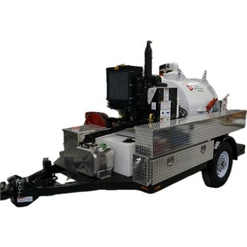
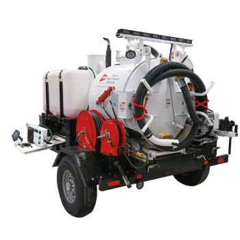
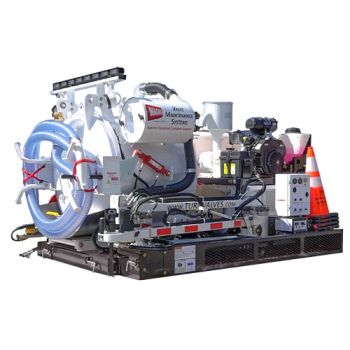
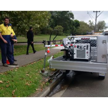
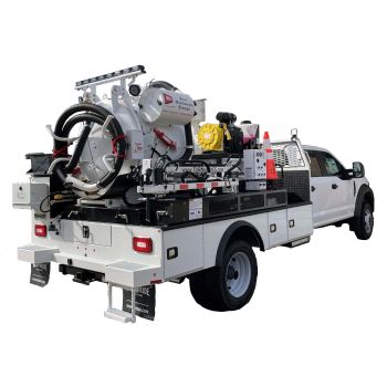
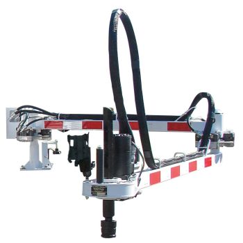
Handheld exercisers to full trailer systems - controlled torque, accurate turn counting, and data that feeds straight into infraMAP®.
The GIS brain of the system - real-time field mapping, inspections, reporting, and asset management, connected anywhere.
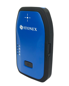
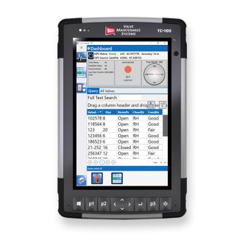
Rugged tablets and sub-foot GNSS receivers built for utility work - precise positioning in any environment.
Downloads
Already an infraMAP® user? Install the Windows desktop app on your tablet or PC to get started. Opens the secure iWater download portal.
Questions
infraMAP® is a cloud-based GIS utility management and maintenance system from iWater. It's a GPS-guided mobile mapping platform that lets field crews locate, inspect, and update water, wastewater, stormwater, gas, and electric assets directly from a tablet - in real time or fully offline.
No. infraMAP® was designed for field crews, not GIS analysts. The interface is simple to learn, and the database can be fully customized to your utility without any GIS background. It brings field crews, management, GIS, and engineering together in one commercial off-the-shelf system.
Yes. infraMAP® runs in real time when connected and fully disconnected when you're out of coverage. Crews keep collecting and inspecting offline, and the data syncs automatically once a connection returns - useful in remote areas.
Yes. infraMAP® records real-time valve-exercising data from E.H. Wachs automated equipment, capturing torque, turn counts, and condition straight into the asset's history. Intermountain Sales supplies both the Wachs equipment and infraMAP® as one connected solution.
infraMAP® is a cloud-based SaaS platform with no software to install. It runs on rugged tablets and standard devices across iOS, Android, and Windows, so crews can use the hardware that fits their workflow.
Yes. infraMAP® 811 receives locate tickets in real time, auto-prioritizes them by date, time, and type, and places them on the map next to your GIS. Crews attach photos and notes, going fully paperless and completing roughly 30% more tickets with the same crew.
infraMAP® is configured to each utility's size and needs, so pricing is provided by quote. Request a quote online or call Intermountain Sales at (303) 762-1070 and we'll scope the right configuration for your system.
Intermountain Sales is the authorized infraMAP® partner serving Colorado, Utah, Wyoming, Montana, and Idaho. We handle demos, implementation consultations, and ongoing support from our offices in Englewood, CO and Taylorsville, UT.
Schedule a demo or implementation consultation and we'll show you infraMAP® running against your utility's GIS.
Call (303) 762-1070
Related products
The rugged field tablet that runs infraMAP® and drives Wachs valve-exercising equipment.
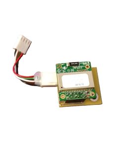
Wirelessly streams valve-exercising data from Wachs equipment into infraMAP®.
Survey-grade positioning for mapping and verifying buried assets in the field.
E.H. Wachs trailer-mounted valve maintenance system - data-ready for infraMAP®.
Cloud-Based GIS Utility Management Software
Advanced Field Solutions for Utilities Across the Rocky Mountain Region
Intermountain Sales Inc. proudly partners with iWater, Inc.—a leader in utility-focused GIS and field data solutions—to bring you infraMAP®, a powerful, cloud-based maintenance management system designed for the unique needs of the water, wastewater, stormwater, gas, and electric industries. Serving municipalities across Colorado, Utah, Wyoming, Montana, and Idaho, we’re helping utilities modernize their asset management with real-time, GPS-driven precision.
About iWater & infraMAP®
Founded in 2000 and headquartered in Irvine, California, iWater specializes in GIS-based field solutions and professional services. Their flagship software, infraMAP®, was originally developed to reduce overtime, eliminate paper-based tasks, and simplify workflows in the field. Refined by real-world utility crews, infraMAP® provides seamless data collection, task management, and maintenance recordkeeping—all from the field.
Whether you’re managing valves, hydrants, manholes, or mains, infraMAP® makes GIS and asset management easy, accurate, and mobile.
Choosing the appropriate frequency is crucial when identifying underground utilities. Factors such as the utility’s depth, size, material, and the level of congestion (closeness to other utilities) all play a role in determining the right frequency. Larger diameter pipes that are directly buried, like those used for water or gas, often have bell housing ends with insulators and rubber gaskets, and thus require a higher frequency. On the other hand, smaller diameter utilities that are well-grounded, directly buried, or span long distances in conduits, function better with a lower frequency.
The VM-810 operates at a frequency of 83.1kHz, making it suitable for locating water and gas utilities, which typically involve larger pipes with bell housings and gaskets. The higher frequency of the VM-810 is also effective for detecting ungrounded small diameter drop wires and for inducing signals through the soil onto services when direct connection is not feasible.
The Distance Sensitive Left/Right Guidance TM
This feature of the VM-810 allows the locator to determine which antenna is receiving the strongest signal, thereby indicating the direction to move to be directly above the buried line.
Key Features & Benefits:
Feature | Description |
Simple & Powerful Interface | Easy-to-learn, field-ready software interface built for maximum usability. |
Customizable Configuration | Fully adaptable database tailored to your utility’s needs—no GIS experience needed. |
Real-Time GPS Integration | Automatically locates crews and assets with built-in GPS for live positioning. |
Digital Drawings Access | View as-built drawings with one click directly from your map interface. |
Live Data Updates | Sync changes and maintenance history across your team instantly. |
Wachs Tool Integration | Seamless data recording from E.H. Wachs valve maintenance equipment. |
Automated Calculations | Perform instant fire flow, leak loss, flushing gallons, and other utility-specific workflows. |
Turn-by-Turn Navigation | Built-in driving directions for fast routing to any address or asset. |
Map Annotations | Use Redline tools to draw, mark, and make notes directly on your GIS. |
Task Assignment & Management | Assign, track, and automate asset tasks in real time. |
Comprehensive Work History | Review the entire maintenance lifecycle of any asset while in the field. |
iWater Services Include:
infraMAP® and iWater bring together GIS intelligence and utility field operations in one seamless solution. Whether you’re upgrading outdated infrastructure workflows or improving compliance and reporting, infraMAP® delivers the power and precision today’s utilities require.
Available now through Intermountain Sales Inc. for the entire Rocky Mountain Region. Contact us to schedule a demo or implementation consultation.


Validate your login